Contact Seller
Elder Books And Collectables
Tel01989762478or07980639356Please quote Antiques Atlas.

 Antique Italian Region Map, Framed Cartography
 Antique Map of Ireland, French, Framed Cartography
 Antique Map of Scotland, French Framed Cartography
 Antique Devon County Map, English, Framed, 17th.C
 Antique Framed Cornwall Map, English, Cartography
 Antique Framed Gloucestershire Map, English Atlas
 John Cary Hand-Coloured Original Map of Sussex
 Old World Map Linen Backed
 Antique Map of Asia, French, Framed, Atlas, C.1800
 John Cary Early 19th Century Framed Map 1816
 Antique Jamaica Map, English, Caribbean, 1790
 Antique Suffolk County Map, Dutch, Atlas Novus
Non UK callers :
+44 1989762478
or +44 7980639356
or +44 7980639356
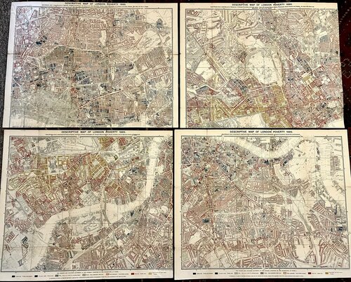
1889 Descriptive Map of London Poverty by C. Booth


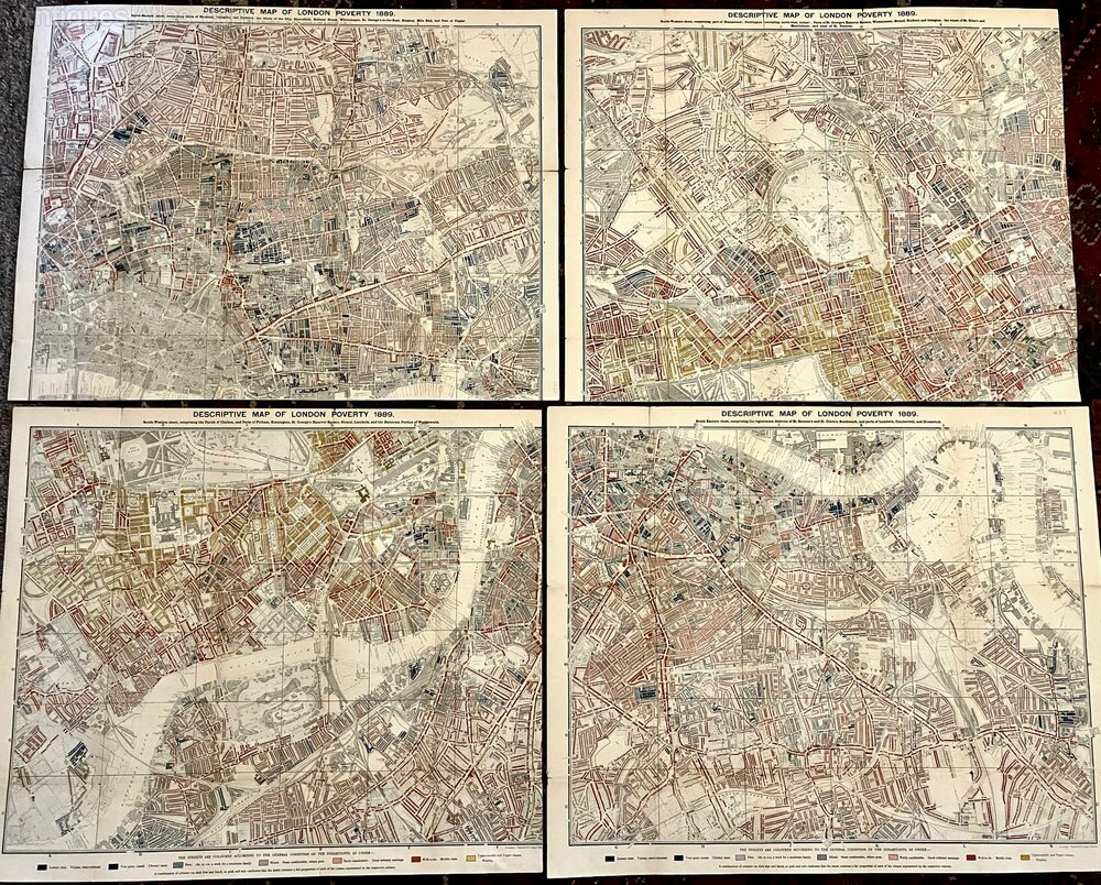
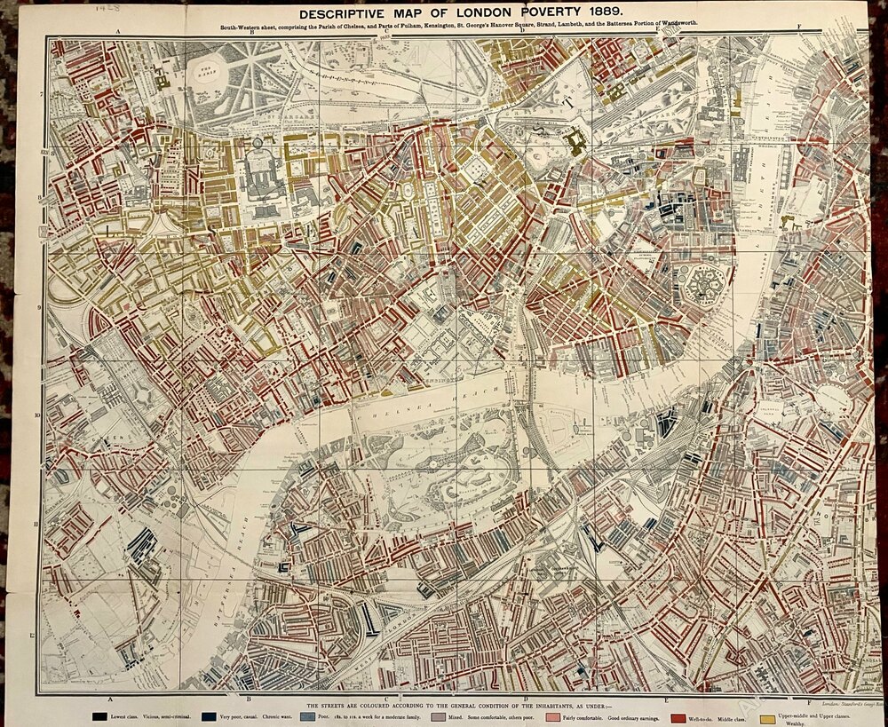
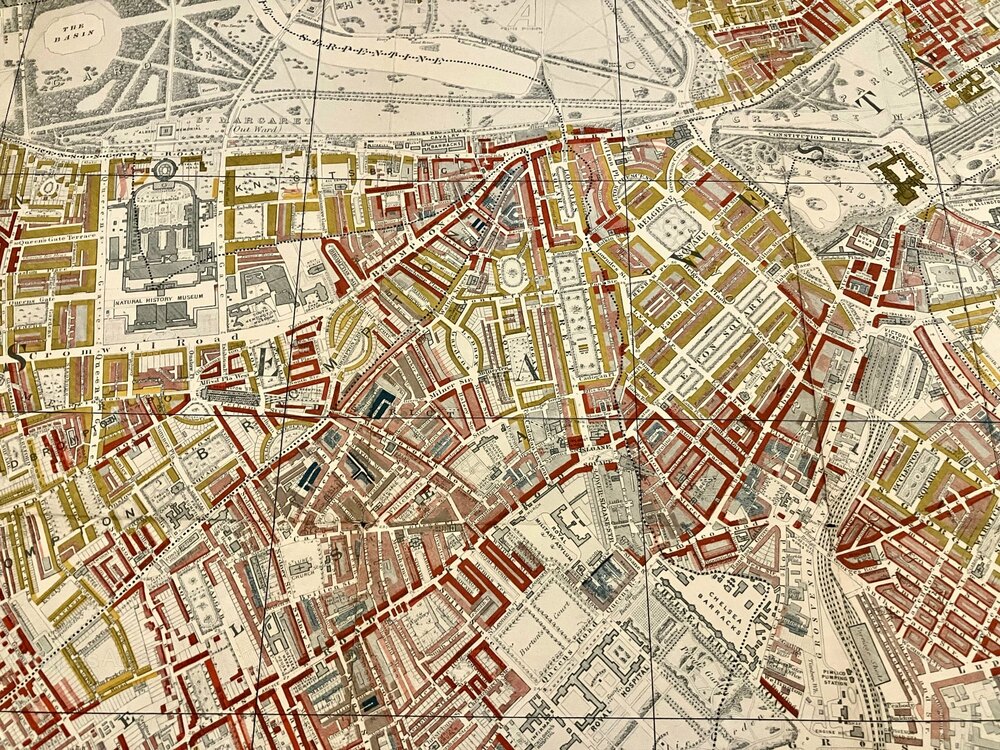
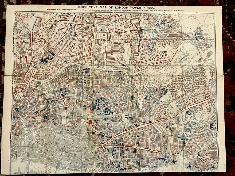
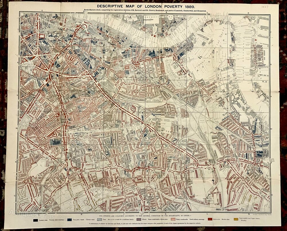
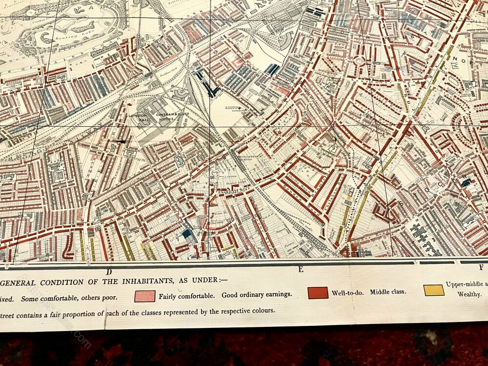
Descriptive Map of London Poverty 1889
By Charles Booth
Published by Stanford's Geographical Establishment, 1889
An Original Large Late 19th Century Lithographed Map With All Four Individual Parts in Sections & Laid Down on Linen as Issued.
Complete With the Colour Key to the Housing of Social Classes.
Each Map Measures Approx 24 X 19 Inches
The Occasional Very Small Hole or Very Small Tear at Some Folds With a Few Small Closed Tears at Some Margins.
Overall These Are in Superb Condition With Colours Bright & Maps Clean.
SellerElder Books And Collectables
View all stock from
Elder Books And Collectables

 Private dealer
By appointment only
Near Walford, Ross on Wye
Herefordshire
Tel : 01989762478
or : 07980639356
Non UK callers : +44 1989762478 or +44 7980639356
By Charles Booth
Published by Stanford's Geographical Establishment, 1889
An Original Large Late 19th Century Lithographed Map With All Four Individual Parts in Sections & Laid Down on Linen as Issued.
Complete With the Colour Key to the Housing of Social Classes.
Each Map Measures Approx 24 X 19 Inches
The Occasional Very Small Hole or Very Small Tear at Some Folds With a Few Small Closed Tears at Some Margins.
Overall These Are in Superb Condition With Colours Bright & Maps Clean.
Price
Click here to message the seller The price has been listed in British Pounds.
Conversion rates as of 30/APR/2026. Euro & Dollar prices will vary and should only be used as a guide.
Always confirm final price with dealer.
DimensionsEach Map Measures Approx 24 X 19 Inches
Category Antique Ephemera
Date 1889
Late Victorian Antiques Material Linen
Origin British
Condition The Occasional Very Small Hole or Very Small Tear at Some Folds With a Few Small Closed Tears at Some Margins.
Overall These Are in Superb Condition With Colours Bright & Maps Clean.
Item code as1207a660 / 631-DR6
Status For Sale
£7500.00 
$10186.50
€8686.50

$10186.50

€8686.50

Looking to Buy?
Arrange a final price and delivery details directly with the dealerClick here to message the seller
Conversion rates as of 30/APR/2026. Euro & Dollar prices will vary and should only be used as a guide.
Always confirm final price with dealer.
Shipping information
Free of charge within the UK via Tracked & Insured Service.
Overseas Buyers - Please contact us for postage costs.
All Books sent in Sturdy Book Box.
Overseas Buyers - Please contact us for postage costs.
All Books sent in Sturdy Book Box.
View all stock from
Elder Books And Collectables

 Private dealer
By appointment only
Near Walford, Ross on Wye
Herefordshire
Tel : 01989762478
or : 07980639356
Non UK callers : +44 1989762478 or +44 7980639356
You may also be interested in
 Antique Italian Region Map, Framed Cartography
 Antique Map of Ireland, French, Framed Cartography
 Antique Map of Scotland, French Framed Cartography
 Antique Devon County Map, English, Framed, 17th.C
 Antique Framed Cornwall Map, English, Cartography
 Antique Framed Gloucestershire Map, English Atlas
 John Cary Hand-Coloured Original Map of Sussex
 Old World Map Linen Backed
 Antique Map of Asia, French, Framed, Atlas, C.1800
 John Cary Early 19th Century Framed Map 1816
 Antique Jamaica Map, English, Caribbean, 1790
 Antique Suffolk County Map, Dutch, Atlas Novus