Antiques for Sale | Antique Furniture | Antique Fairs | Antiques Listings | Antiques Email Alerts | Websites for Antique Dealers | Contact
Torr Antiques & Decorative Arts
Tel : 07931 370 372
Email : david.torr@btinternet.com
Web : www.antiques-atlas.com/torrantiques/
Private dealer
By appointment only
Lamberhurst
Kent, England
Viewing by appointment only.
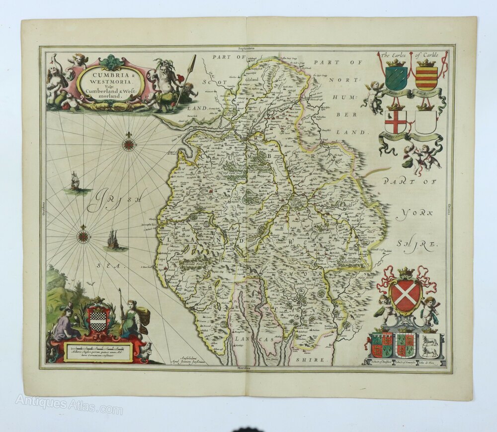
Jan Jansson Map of Cumbria & Westmoria c.1646


Photos
Description
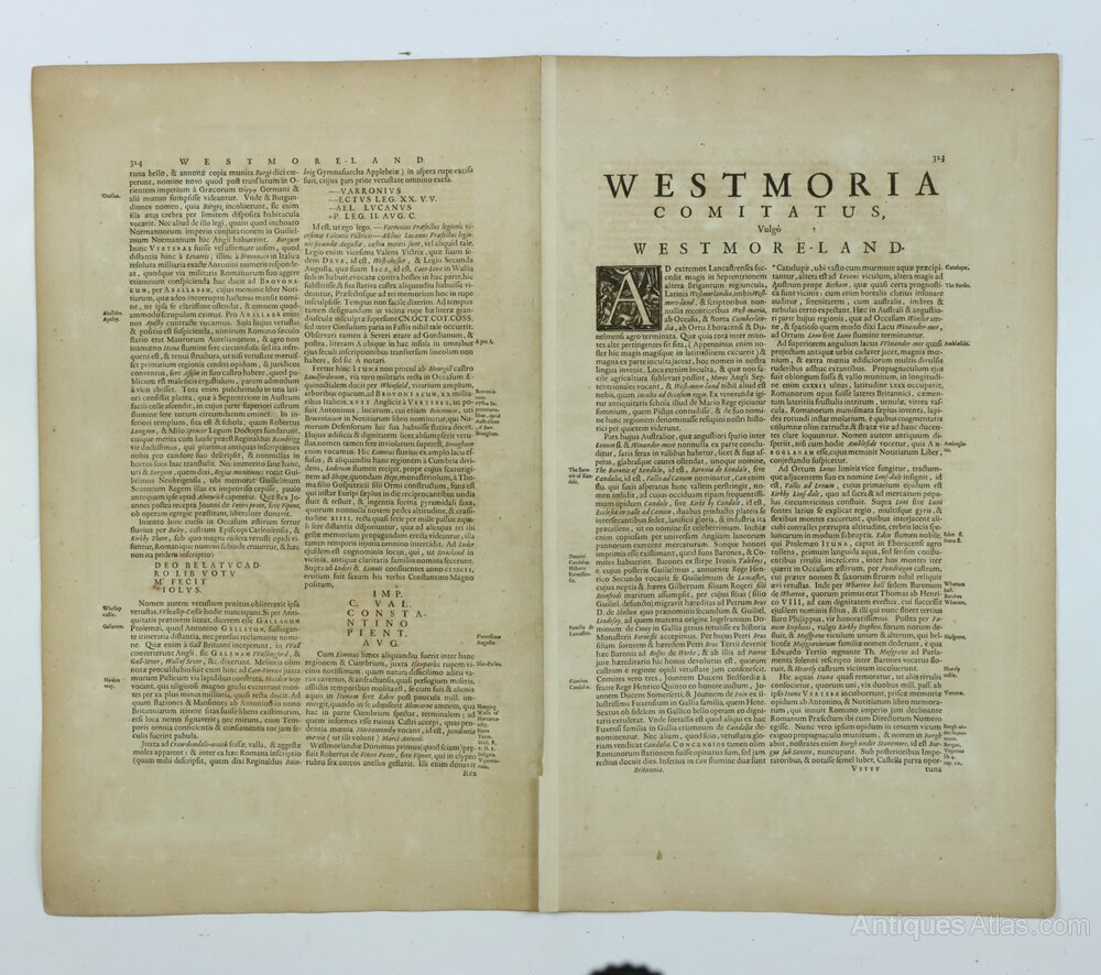
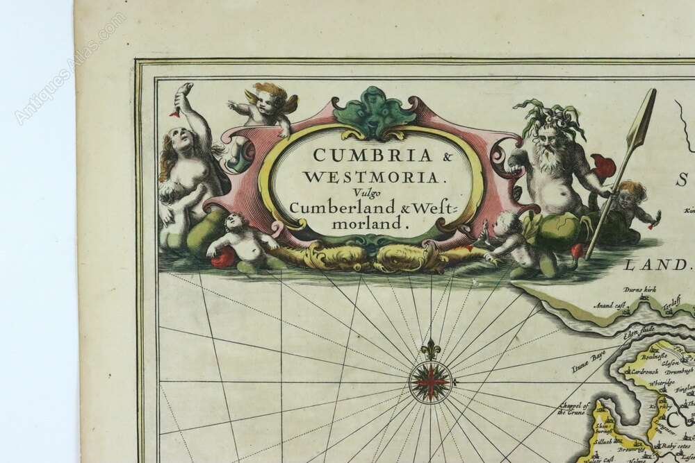
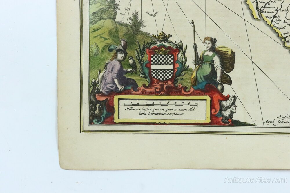
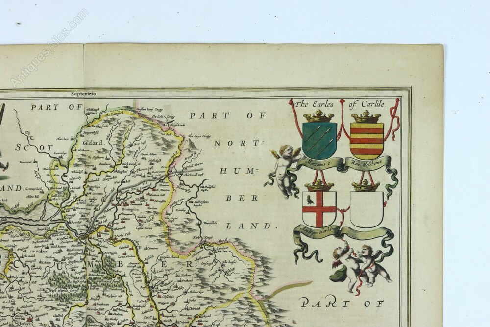
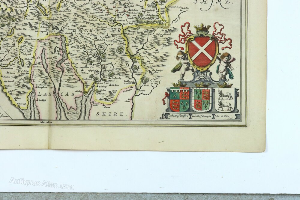
A hand-coloured original mid 17th century copperplate engraved map of Cumbria and Westmoria (now called Cumbria) by Jan Jansson, published c.1646 in Amsterdam, in very good antique condition. It has a decorative title cartouche, ornamental scale bar, several coats of arms supported by winged putti and two sailing ships and two compass roses in the Irish Sea. Latin verso.Dimensions: Paper - 49 x 59 cm
Imprint (image) - 42.5 x 54 cm
Condition: A lovely clean example of this map with good margins and without any tears or repairs it would frame very well. It is also attractively coloured.
Postage: £6 within the UK, rolled in a tube.
Shipping information
We have a trusted delivery man who is a experienced in transporting antiques, pictures and fragile items. He can deliver to most places on mainland England and Wales and, depending on where he is on his schedule, it may take a few days or up to 4 weeks. Other couriers are available for Scotland and North Wales or where a shorter time frame is required. Purchases can also be collected in person from the Tunbridge Wells area in SE England.
DateMid 17th Century
Codeas1016a808
Price £175.00  €202.11
  $236.37
  The price has been listed in British Pounds.
Conversion rates as of 6/JAN/2026.
Euro & Dollar prices will vary and should only be used as a guide.
Always confirm final price with dealer. Payment with PayPal is available for this item.
Please contact the seller below for further details.
 StatusFor Sale
SellerTorr Antiques & Decorative Arts
Telephone07931 370 372Non UK callers :+44 7931 370 372 Emaildavid.torr@btinternet.com
StatusFor Sale
SellerTorr Antiques & Decorative Arts
Telephone07931 370 372Non UK callers :+44 7931 370 372 Emaildavid.torr@btinternet.com
 €202.11
  $236.37
  The price has been listed in British Pounds.
Conversion rates as of 6/JAN/2026.
Euro & Dollar prices will vary and should only be used as a guide.
Always confirm final price with dealer. Payment with PayPal is available for this item.
Please contact the seller below for further details.
 StatusFor Sale
SellerTorr Antiques & Decorative Arts
Telephone07931 370 372Non UK callers :+44 7931 370 372 Emaildavid.torr@btinternet.com
StatusFor Sale
SellerTorr Antiques & Decorative Arts
Telephone07931 370 372Non UK callers :+44 7931 370 372 Emaildavid.torr@btinternet.com
Contact
Send Torr Antiques & Decorative Arts a message about this item here