Antiques for Sale | Antique Furniture | Antique Fairs | Antiques Listings | Antiques Email Alerts | Websites for Antique Dealers | Contact

Torr Antiques & Decorative Arts
Tel : 07931 370 372
Email : david.torr@btinternet.com
Web : www.antiques-atlas.com/torrantiques/
Private dealer
By appointment only
Lamberhurst
Kent, England
Viewing by appointment only.
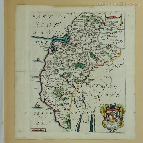
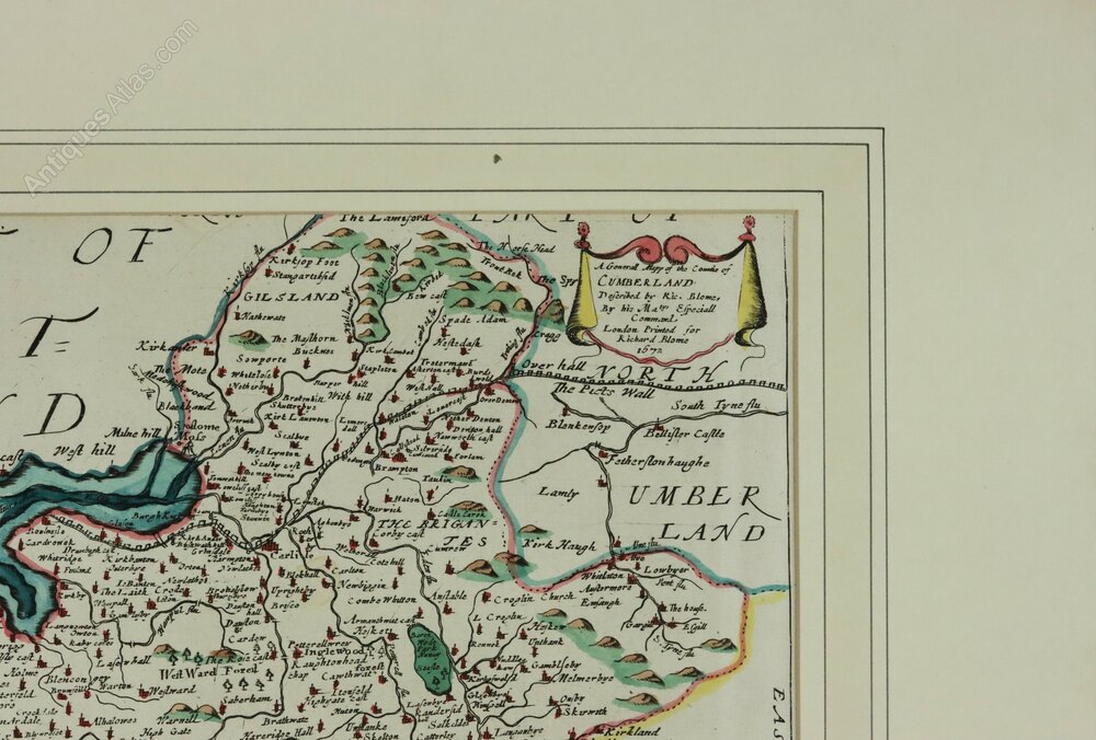
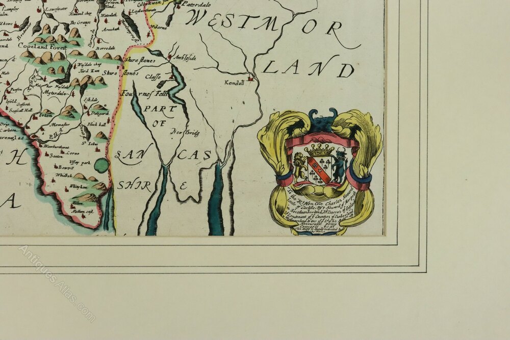
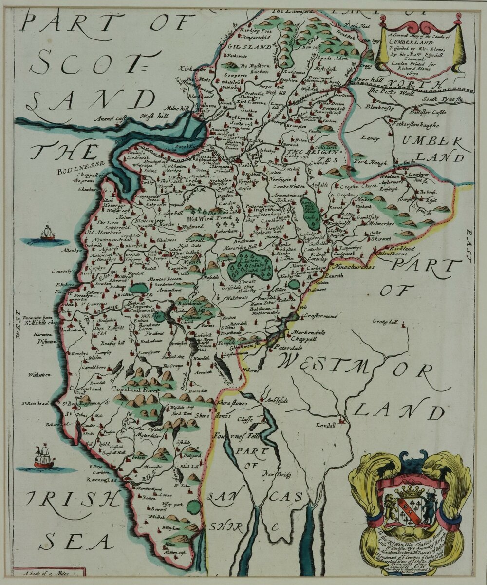
Richard Blome Map of Cumberland, 1673

Photos

Description
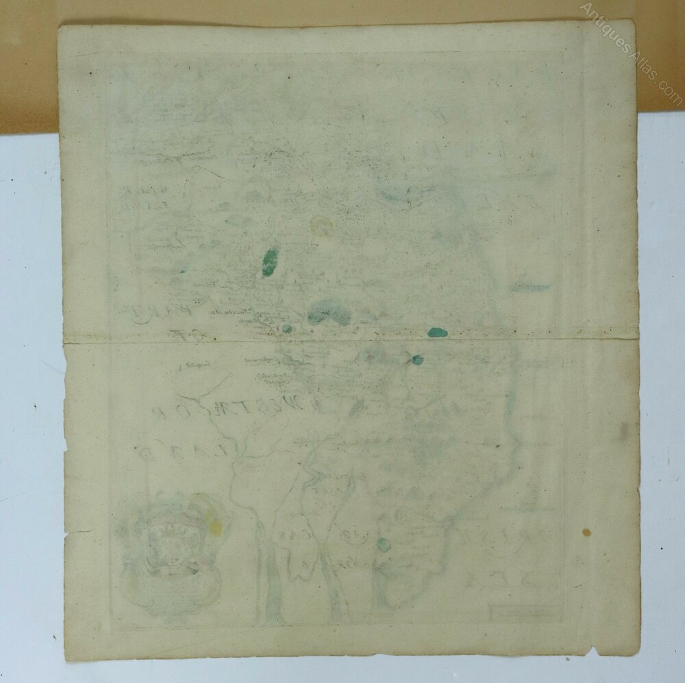
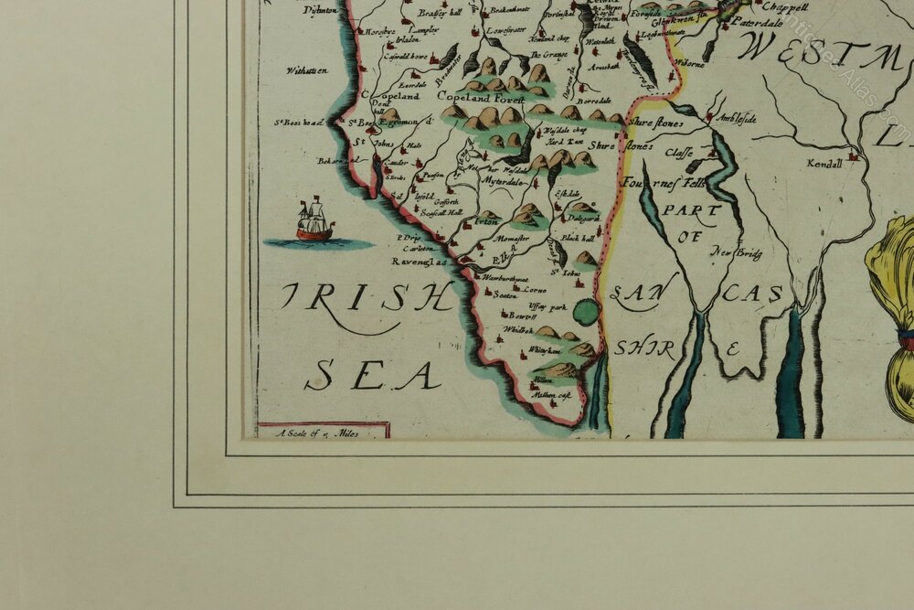
A genuine copper engraved map by Richard Blome published in 1673 in 'Britannia', attractively coloured and with good margins. It features a title cartouche (with the date for 1672), a scale, and a dedication to the Earl of Carlisle with his coat-of-arms (containing a lion and a bull) and two sailing ships in the Irish Sea. Plain verso.Dimensions: Paper 35.5 x 32 cm, Imprint (image) 32.3 x 25.5 cm
Condition: Hand-laid paper in good clean condition with centre fold as published. It is currently presented in an old mount which we have left on to help protect the map. The map is connected to the backing board by a thin piece of tape.
Postage: The map can be posted between thick card for £6.00
Shipping information
We have a trusted delivery man who is a experienced in transporting antiques, pictures and fragile items. He can deliver to most places on mainland England and Wales and, depending on where he is on his schedule, it may take a few days or up to 4 weeks. Other couriers are available for Scotland and North Wales or where a shorter time frame is required. Purchases can also be collected in person from the Tunbridge Wells area in SE England.
DateCromwellian :
1673
Codeas1016a807
Price £95.00  €109.54
  $127.51
  The price has been listed in British Pounds.
Conversion rates as of 19/JAN/2026.
Euro & Dollar prices will vary and should only be used as a guide.
Always confirm final price with dealer. Payment with PayPal is available for this item.
Please contact the seller below for further details.
 StatusFor Sale
SellerTorr Antiques & Decorative Arts
Telephone07931 370 372Non UK callers :+44 7931 370 372 Emaildavid.torr@btinternet.com
StatusFor Sale
SellerTorr Antiques & Decorative Arts
Telephone07931 370 372Non UK callers :+44 7931 370 372 Emaildavid.torr@btinternet.com
 €109.54
  $127.51
  The price has been listed in British Pounds.
Conversion rates as of 19/JAN/2026.
Euro & Dollar prices will vary and should only be used as a guide.
Always confirm final price with dealer. Payment with PayPal is available for this item.
Please contact the seller below for further details.
 StatusFor Sale
SellerTorr Antiques & Decorative Arts
Telephone07931 370 372Non UK callers :+44 7931 370 372 Emaildavid.torr@btinternet.com
StatusFor Sale
SellerTorr Antiques & Decorative Arts
Telephone07931 370 372Non UK callers :+44 7931 370 372 Emaildavid.torr@btinternet.com
Contact
Send Torr Antiques & Decorative Arts a message about this item here